

Chapter 2: Shaping of the Earth's Surface
Mountains rise, rivers cut valleys, coasts crumble — what invisible forces are reshaping the ground under your feet?
Original notes — ready CBSE (NCERT, English Medium) • Class 9 • Social Science • Book: Understanding Society: India and Beyond — Part 1
Chapter 2: Shaping of the Earth's Surface — EG's own notes, in simple words
Book: Understanding Society: India and Beyond — Part 1 (CBSE, Class 9) | Chapter 2 | Medium: English
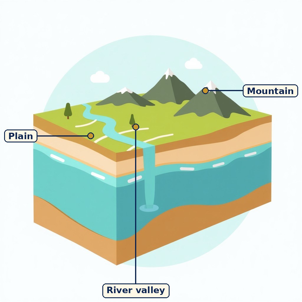
Diagram (labels are printed on the image): Mountains, a river valley and a plain in one landscape. A general diagram of landforms, not a map from the book.
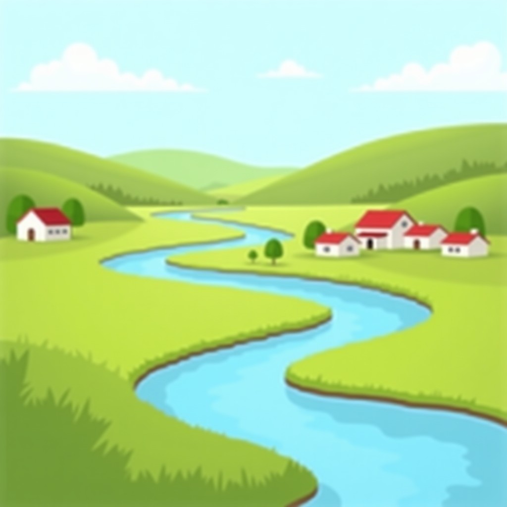
A river shaping a valley as it flows towards the plains. A general picture of a changing landscape, not a book scene.
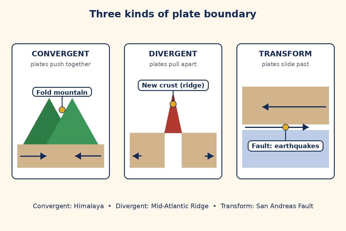
New diagram (labels are printed on the image): Convergent boundaries push together and raise fold mountains; divergent boundaries pull apart and create new crust; transform boundaries slide past and cause earthquakes. Gold dots sit on the mountain, the new crust and the fault.
What the chapter is about
The Earth's surface is never still. Mountains rise, rivers cut valleys, winds move sand and sea waves wear away coasts — very slowly over thousands or millions of years, but also suddenly, in an earthquake or a flood. Two families of forces do this work. Internal (endogenic) forces act from inside the Earth and build land up; external (exogenic) forces — running water, glaciers, wind, waves and groundwater — wear land down, carry the material away and lay it down elsewhere. The landscape we see today is the result of both, and landforms in turn shape where people live, farm, build and trade.
Inside the Earth and plate tectonics
The Earth has three main layers: the crust on which we live, the very thick and hot mantle below it, and the extremely hot and heavy core at the centre. The crust together with the upper mantle forms the lithosphere, which is broken into tectonic plates. Beneath it lies the asthenosphere, a semi-molten layer over which the plates move slowly, usually a few centimetres per year. The theory of plate tectonics, given by W. J. Morgan, says the outer layer is not one piece but several large and small plates — continental plates carrying continents, oceanic plates carrying ocean floors, and mixed plates carrying both. Major plates include the Pacific, Eurasian, African, North American, South American, Indo-Australian and Antarctic plates. Plates move because of convection currents in the mantle: heat from the core makes molten material rise while cooler material sinks, pushing and pulling the plates.
Three plate boundaries
Where plates meet, there are three kinds of boundary. At a convergent boundary, plates move towards each other: colliding continental plates raise fold mountains such as the Himalaya, while an oceanic plate sinking beneath a continental plate causes volcanic activity and earthquakes. At a divergent boundary, plates move apart and magma rises to form new crust, creating mid-ocean ridges such as the Mid-Atlantic Ridge. At a transform boundary, plates slide past each other without creating or destroying crust, mainly causing earthquakes, as along the San Andreas Fault in the United States. Most earthquakes and volcanoes occur along plate boundaries, especially around the Pacific Ocean in the Ring of Fire. In early India, earthquakes were called "bhukampa", and Varahamihira's Brihatsamhita discussed signs that might signal them. India itself has earthquake risk: the major Gujarat earthquake of 2001 caused extensive damage and thousands of deaths.
Weathering, erosion and gradation
Weathering breaks rocks down in place, without movement: physical weathering by temperature changes, frost, wind or ice; chemical weathering by reactions with water, air or acids; and biological weathering by plants, animals or micro-organisms, for example roots splitting cracks. Erosion wears material away and carries it somewhere else — by water, wind, ice or waves. Erosion matters to livelihoods: it strips fertile topsoil from farmers' fields, washes away land, houses and roads near rivers and coasts, destabilises construction and mining sites, and damages tourism and fishing. People have long fought it: the Sindhu-Sarasvati civilisation used contouring, bunding, terracing, dams and canals, and Nagaland's Zabo system uses earthen bunds on hillslopes for soil and water conservation. Together, wearing down, transport and deposition are called gradation: agents of gradation — running water, glaciers, wind, waves and groundwater — lower high areas and fill low ones, levelling the surface over time.
Landforms made by each agent
Running water: in the upper course, steep gradients carve V-shaped valleys, waterfalls and rapids (a waterfall forms where hard rock resists erosion while softer rock below wears away, leaving a plunge pool). In the middle course the river meanders — eroding outer banks, depositing on inner banks — and forms oxbow lakes and floodplains. In the lower course it deposits sediment as deltas (fan-shaped, fertile, good for rice and jute, but flood-prone), levees and alluvial fans. The Grand Anicut (Kallanai) in Tamil Nadu shows rivers used for irrigation. Waves and currents build beaches, sand bars, sea cliffs, sea caves, arches and stacks: waves undercut a headland into a cave, the cave becomes an arch, and the collapsed arch leaves a stack. Glaciers carve U-shaped valleys, cirques (bowl-shaped hollows), aretes (sharp ridges), hanging valleys and fjords, and deposit moraines — lateral (sides), medial (middle, where two glaciers meet) and terminal (at the farthest advance) — which can make fertile soil, dams and lakes. Wind carves yardangs (streamlined ridges), ventifacts (sand-blasted rocks) and deflation hollows, and builds dunes — barchan (crescent), longitudinal (parallel to wind), star (winds from many directions) and parabolic (U-shaped, often stabilised by vegetation). Underground water in limestone creates karst topography: caves, stalactites (hanging from the ceiling), stalagmites (rising from the floor), sinkholes or dolines, and underground rivers.
Landforms, people and disasters
Landforms have shaped history itself: fertile river plains like the Ganga, Nile, Brahmaputra and Indus gave rise to agricultural societies and early cities; the Himalayas shielded India from invasions while passes like the Khyber allowed cultural exchange; the Thar desert limited large settlements but encouraged trade routes like the Silk Route; coasts and harbours supported trade and helped south Indian kingdoms flourish. Four disasters are tied to landforms in this chapter. Landslides come from heavy rain soaking slopes, earthquakes or eruptions shaking them, and human actions — deforestation, mining, road building, unplanned hillside construction and poor drainage. Avalanches happen when heavy snowfall, warming, wind-piled snow or vibrations destabilise a steep snowpack. GLOFs (Glacial Lake Outburst Floods) occur when a glacial lake's ice or moraine dam collapses — because of rapid melting, heavy rain or snow, or an earthquake, avalanche or landslide — releasing stored water as a destructive flood; the February 2021 Chamoli flood in Uttarakhand is the chapter's warning example. Dust storms strike dry, sandy regions when strong winds lift loose particles. For every disaster, the chapter asks students to list prone areas, mitigation measures and recent examples — preparedness, not just description, is the point.
What you should learn
After this chapter you should be able to: name the Earth's layers and explain plate movement by convection currents; distinguish the three plate boundaries with one example each; distinguish weathering (breaking in place) from erosion (breaking plus movement) and name their types; match each agent of gradation to its landforms (waterfall, meander, delta, beach, arch, stack, U-valley, moraine, dune, stalactite/stalagmite); explain how landforms shape human life; and describe the causes of landslides, avalanches, GLOFs and dust storms with mitigation ideas.
Key Terms
- Landform — A natural feature of the Earth's surface, such as a mountain, valley or plain.
- Lithosphere — The rigid outer layer of the Earth, made of the crust plus the upper mantle, broken into tectonic plates.
- Asthenosphere — The hot, semi-molten layer below the lithosphere over which plates move.
- Plate tectonics — The theory that the Earth's outer layer is divided into slowly moving plates whose movements create landforms, earthquakes and volcanoes.
- Convergent / divergent / transform boundary — Plates moving together / apart / sliding past each other.
- Weathering — Breaking down of rock in place, without movement (physical, chemical, biological).
- Erosion — Wearing away and carrying away of rock and soil by water, wind, ice or waves.
- Deposition — Laying down of eroded material in a new place, building new land.
- Gradation — The combined work of wearing down, transport and deposition that levels the Earth's surface.
- Karst topography — Landforms made by underground water dissolving soluble rock, such as caves and sinkholes.
- GLOF — Glacial Lake Outburst Flood: sudden release of water when a glacial lake's dam collapses.
Remember
- Internal forces build land up; external forces wear it down and rebuild it elsewhere.
- Weathering = breaking in place. Erosion = breaking PLUS movement. Do not swap them.
- Convergent → fold mountains; divergent → new crust and ridges; transform → earthquakes.
- Most earthquakes and volcanoes cluster along plate boundaries — the Ring of Fire.
- Each agent has signature landforms: rivers make meanders and deltas; glaciers make U-valleys; wind makes dunes; groundwater makes caves.
- Disasters have both natural causes and human causes — and mitigation is part of the answer.
Exam Tip / Common Mistake
Common mistake: writing that "erosion breaks rocks" and stopping there — that is weathering. Always add movement for erosion. Another frequent slip: mixing up stalactites and stalagmites — remember stalactites hold on tight (ceiling) and stalagmites push up with might (floor). In boundary questions, always name the boundary type, the direction of movement and one named example (Himalaya, Mid-Atlantic Ridge, San Andreas Fault) — that trio earns full marks.
Chart / Table: Agents of gradation and their landforms
| Agent | Erosion landforms | Deposition landforms |
|---|---|---|
| Running water | V-shaped valley, waterfall, meander | Floodplain, levee, delta, alluvial fan |
| Waves | Sea cliff, sea cave, arch, stack | Beach, sand bar |
| Glaciers | U-shaped valley, cirque, arete, fjord | Moraines (lateral, medial, terminal) |
| Wind | Yardang, ventifact, deflation hollow | Dunes (barchan, longitudinal, star, parabolic) |
| Groundwater | Caves, sinkholes | Stalactites, stalagmites, pillars |
Practice set — try it yourself
- What are tectonic plates, and what makes them move?
Hint: Think of a cracked shell floating on something hot and slowly stirring. - Name the three plate boundaries and one result of each.
Hint: Together, apart, sliding past — mountain, ridge, earthquake. - What is the difference between weathering and erosion?
Hint: One stays in place; the other travels. - List two landforms made by rivers and two made by wind.
Hint: Rivers: bends and mouths. Wind: desert shapes. - Why are earthquakes and volcanoes common around the Pacific?
Hint: Think about where plates meet.
Questions with Answers
- What is plate tectonics, and why does it matter?
Plate tectonics is the theory (given by W. J. Morgan) that the Earth's lithosphere is broken into large and small plates that move a few centimetres per year over the semi-molten asthenosphere, driven by convection currents in the mantle. It explains mountains, valleys, ocean basins, volcanoes and earthquakes, and helps identify earthquake- and volcano-prone regions for disaster management. - How do the three plate boundaries differ?
Convergent boundaries push plates together — continental collision raises fold mountains like the Himalaya; oceanic plates sinking beneath continental plates cause volcanoes and earthquakes. Divergent boundaries pull plates apart — magma rises and forms new crust, such as the Mid-Atlantic Ridge. Transform boundaries slide plates past each other without creating or destroying crust, mainly causing earthquakes, as along the San Andreas Fault. - Distinguish weathering from erosion, with types.
Weathering breaks rock down in place without movement — physical (temperature, frost, wind, ice), chemical (reactions with water, air, acids) and biological (roots, animals, micro-organisms). Erosion wears material away and carries it elsewhere by water, wind, ice or waves. Weathering prepares the material; erosion transports it. - How does a river shape land differently in its three courses?
In the upper course, steep gradients carve V-shaped valleys, waterfalls and rapids. In the middle course the river meanders, eroding outer banks and depositing on inner banks, forming oxbow lakes and floodplains. In the lower course it slows and deposits sediment as deltas, levees and alluvial fans — fertile, good for farming, but flood-prone. - What causes a GLOF, and why is it dangerous?
A Glacial Lake Outburst Flood happens when a glacial lake grows because of rapid melting, then its natural dam of ice or loose moraine collapses — triggered by heavy rain or snow, an earthquake, avalanche or landslide. The stored water escapes suddenly as a destructive flood downstream, damaging buildings, roads, bridges and hydel projects, as in the Chamoli flood of February 2021.
Extension Questions with Answers
- Why can a renewable-looking landscape still be damaged permanently by erosion?
Because erosion removes topsoil faster than soil formation replaces it. A farmer's field may look green, but once the fertile top layer is washed away, yields fall for years. That is why contouring, bunding, terracing and the Zabo system matter: they slow water, hold soil and recharge groundwater instead of letting both escape. - How do landforms explain both protection and contact in Indian history?
Mountains like the Himalayas shielded India from invasions, yet passes like the Khyber allowed cultural exchange; fertile plains supported cities and farming; deserts like the Thar limited settlement but encouraged trade routes such as the Silk Route; coasts and harbours let south Indian kingdoms trade overseas. The same physical features acted as barriers in one direction and bridges in another. - If earthquakes cannot be predicted exactly, what can societies still do?
They can map prone zones (most quakes follow plate boundaries), enforce earthquake-resistant building, keep emergency plans and drills, avoid unplanned hillside construction, and protect slopes from deforestation and poor drainage that turn shaking into landslides. Prediction is uncertain; preparedness is not. - Why does the chapter treat a delta as both a gift and a risk?
Deltas have rich alluvial soil ideal for rice and jute, support fishing where fresh and salt water mix, and host dense settlements and trade along navigable rivers. But the same low, flat land floods easily, so the gift of fertility comes with the risk of flood damage — settlement and farming there need embankments, drainage and warning systems. - Draw and label a meander and a delta — what must each label show?
A meander must show the river bend, the steep eroding outer bank, the gently depositing inner bank (bar) and, if the loop is cut off, the oxbow lake. A delta must show the main river, distributaries splitting across the fan, islands or bars of deposited sediment, and the sea or lake it flows into. Labels must name the process too: erosion on the outside, deposition on the inside and at the mouth.
- Layers: crust, mantle, core; lithosphere (plates) over asthenosphere (semi-molten).
- Boundaries: convergent (mountains), divergent (new crust), transform (earthquakes).
- Weathering breaks in place; erosion carries; gradation levels.
- Agents: water, waves, glaciers, wind, groundwater — each with signature landforms.
- Disasters: landslides, avalanches, GLOFs, dust storms — natural + human causes, mitigation matters.
How to use this page: Read the summary, say the Key Terms in your own words, then try the practice set without looking. Use the Questions with Answers to check yourself afterwards. Ask your teacher or parent to check your answers.